Top of the World - Passport in Time
Main menu:
Previous Projects > States G-L
Top of the World Surveys
Nez Perce National Forest, Idaho, 2009
By Steve Armstrong, Archaeologist, Nez Perce National Forest, Grangeville, Idaho
The Top of the World Survey PIT Project was held on the Salmon River Ranger District of the Nez Perce National Forest the last week of July, 2009. This name was chosen because the areas where we were performing archaeological survey, between 7000' and 8000', are some of the highest elevations on this forest and you feel like you are on top of the world. Surveys took place within and just outside of the Gospel-Hump Wilderness. On a very clear day you can you can see into three neighboring states...Oregon and Washington to the west and Montana to the east.
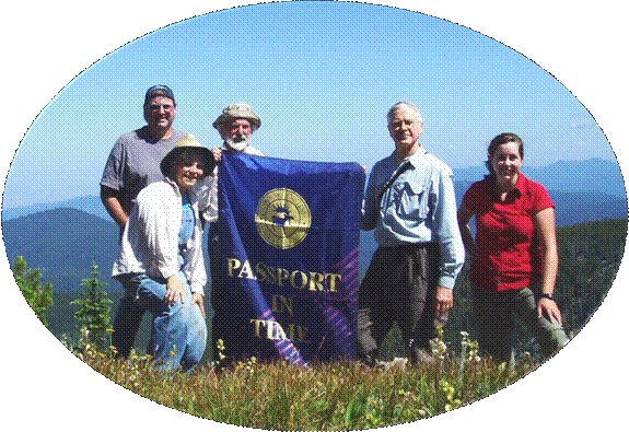 (Photo: The survey crew (l to r): Steve Armstrong, Carol Poppenga, Thomas Darnell, Walt Socha, & Katie Cheney)
Our eager volunteers came from Montana, Oregon and Texas. Each day we spent hiking the high ridgelines and mountain tops while looking for signs of past human use of those areas. By the end of the week, three new archaeological sites had been located and documented and 270 acres had been surveyed. Two of the sites have prehistoric Native American Indian affiliation and one site is a historic mining location. The finding of a historic mining site at these high elevations within the Gospel Hump Wilderness was something that had not previously been documented. We also revisited four known prehistoric sites. All of the new information collected from these sites was added to our database for those locations.
This project provided an opportunity to archaeologically investigate the high elevation settings which had not previously been inventoried by archaeologists. Evidence of past prehistoric and historic use was found in many areas. Several isolated artifacts were also discovered which may have been discarded or lost while prehistoric peoples traveled through this region during their annual movements. Based upon the temporally diagnostic artifacts (such as projectile points) from these sites, these newly documented sites reinforce the data for prehistoric use of the area within the past 5000 years. These high elevation areas were only seasonally available for use from late spring to early fall due to excessive snow pack prohibiting travel and other use during the winter months. Hunting of game animals and gathering of various plant resources such as roots and berries, as they became available, was likely performed by these hardy groups during the snow free months.
The historic mining site was unexpected and provides new evidence that areas outside of the more heavily occupied mining regions across the Nez Perce National Forest were also explored. This is the first time mining exploration has been identified at this high elevation setting within this portion of the Wilderness.
Discoveries of other historic items such as the deteriorated remains of a tree possessing telephone wire and a white porcelain phone line insulator indicate the presence and use of the area by the Forest Service. The Forest Service established fire lookout cabins and towers and other structures in the area in the early 1900s to administer the newly created Nez Perce National Forest.
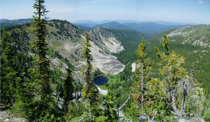 (Photo: One of the many distant vistas available during the PIT project)
Overall, the project was successful for interacting with the public promoting cultural resource awareness. All of the data collected as a result of this project continues to provide evidence that these high elevation settings were used throughout the prehistoric and historic time periods for many purposes. These same areas continue to be utilized today in many ways, including some for the same purposes as those from long ago.